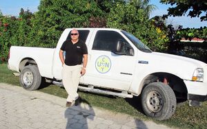
Leogane, Haiti -
Water Resources Assessment
March 2010 - ongoing
Leogane, hit hardest by the Janaury 10, 2010 earthquake, lies just 30 kms west of Port-au-Prince in an alluvial coastal plain. The town of Leogane regularly suffers from flooding even during moderate rainfall events. This is largely due to the reforestation in the uplands as there is too little vegation and soil left to hold back the rainfall which gushes downstream trying to squeeze through conveyance systems that are clogged up because of the material swept down the hill sides. In addition, access to reliable potable water supplies is difficult, in fact the town has no functional water distribution system, even though enough water (volume) is available.
We have set out to work with local institutions, such as DATIP and CODEP, to help develop an integrated watershed management plan to manage the regions water resources for the future. In order to do this, we first set out to better understand the hydrologic conditions of the watersheds of the coastal plain for which we have deployed hydro-met stations and well monitors in addition to developing numerical representations.
Lakes Azuei and Enriquillo, Haiti and Dominican - Republic
Lake Expansions
June 2012 - ongoing
Lakes Azuei and Enriquillo have undergone dramatic changes in the past 5-10 years, expanding and innundating vast swaths of arable land and road infrastrucutre. The reasons for these expansions are not clear and several theories have been put forward as to why this has been happening. While some suggest that the tectonic activity of the Enriquillo Garden Fault that runs underneath the lakes may have shifted the sub surface supply (sprigns) and drainage situation, more promising theories suggest that increased orographic rainfall in the montane forrest regions of the surrounding mountains due to climate shifts may be responsible for these expansions.
Researchers at the City College of New York (CCNY) and the Instituto Tecnologico de Santo Domingo (INTEC) in conjunction with the Haitian Ministry of the Environment and PIWAREC have partnered to investigate the cause(s) for this phenomenon by applying numerical representation of the Lake's watersheds to track the components of the hydrologic cycle. We also deploy high resolution climate models to obtain weather data for future prediction that are informed through a chain of downscaling steps going from global climate to regional (Caribbean), to local (western portion of Hispaniola) grids.
more to come
